




Walk Through These Hidden Gem Nature Areas in Clark And Floyd Counties
Want to take a walk in nature close to the Ohio River communities of New Albany, Clarksville and Jeffersonville? Sure, we have trail hikes at Falls of the Ohio State Park, Charlestown State Park, Deam Lake State Recreation Area and Clark State Forest. But I want to highlight some hidden gems that are off the beaten path and less traveled, almost guaranteeing you a peaceful walk in the woods. These small nature parks nestled throughout Clark and Floyd counties are the ideal places to immerse yourself in the area’s wildlife and flora.
Let’s learn more about three secret nature trails you should explore in Southern Indiana:
1. Silver Hills Historical Nature Trails & Wildlife Sanctuary
900-1198 Spring Street Hill, New Albany, Indiana 47150
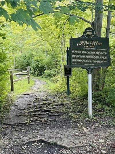
Venture west of downtown New Albany for the first hidden gem. As 8th Street starts to ascend Spring Street Hill into the knobs sits Silver Hills Historical Nature Trails & Wildlife Sanctuary. A small gravel parking lot fits a half dozen vehicles.
I highlight this trail first because it holds unique features, in addition to being in a tranquil natural setting. It’s a walk through local trolley line history. The Silver Hills Historical Society meticulously charted the trolley and community’s key moments in photos, remnants and written accounts along this one-mile loop dirt path that follows a section of the original roadbed of the trolley line. It also meanders along Fall Run stream.
There is a sign at the west trail entrance denoting the trolley line history. It reads:
SILVER HILLS TROLLEY CAR LINE (1891-1932)
The Silver Hills New Highland Railway was established in 1890. Construction began in early 1891, and the line opened for passenger service on the 4th of May. Patrons boarded the electric cars at a depot located on West Spring and Eighth Streets. The Highland Railway served the community of Silver Hills exclusively for 14 years, providing transportation to homes on the Hill, Scenic Park and the Silver Heights Camp Grounds. In 1905, the Highland Railway was sold to the Louisville & Southern Indiana Traction Company. The depot was removed, and the track was connected to the city streetcar line. It continued to serve Silver Hills until May of 1932, when the line ceased operation.
Explore Silver Hills, enjoy nature and go back in time! To learn more about Silver Hills, check out Visit Indiana’s post.
2. Campbell-Woodland Nature Trails
3273 Budd Road #3295, New Albany, Indiana 47150
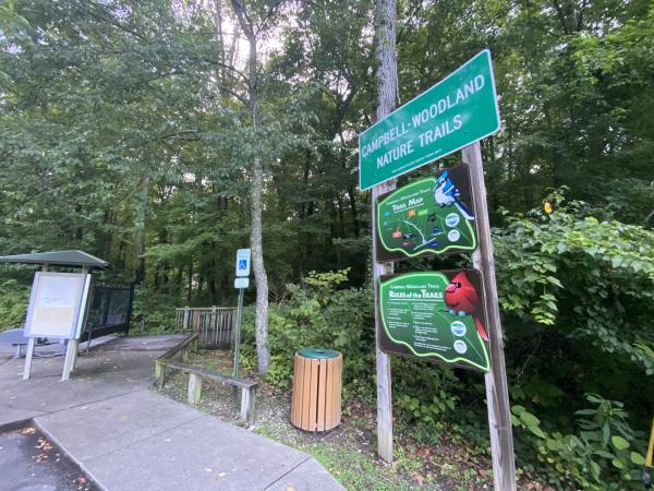
Campbell-Woodland Nature Trails is just a short drive from downtown New Albany. Travel west on Hwy 111 to Budd Road. Enjoy the winding road to the 122-acre nature preserve. There is a paved parking lot and trail information at the trailhead. The trail starts out paved and offers a mix of boardwalks and gravel and dirt paths (¾ mile in length) that loop back to the paved path. The ⅓ mile paved trail is a great handicap accessible trail option. There are small creek beds to explore and even a waterfall. Campbell-Woodland is also dog-friendly. This is one of my favorite places to wander around the creek with my dog.
This is a serene spot in the rolling hills of Southern Indiana. Benches line the path to rest and take in the bird songs. There is also a solar powered automated system that tells the history of the site. Learn more at Floyd County Parks.
3. Buttonbush Woods Mill Creek Trail
Access from George Rogers Clark Boat Ramp
1170 Harrison Avenue, Clarksville, Indiana 47129
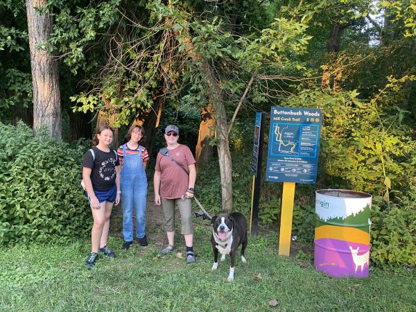
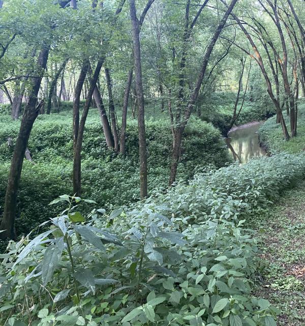
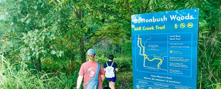
Buttonbush Woods is part of Origin Park, a massive 400-acre recreational area in development. The project is still in progress, but, when complete, it will offer users the opportunity to experience the Ohio River shoreline, even when the water is at flood stages.
To access the Mill Creek Trail, park at the George Rogers Clark Boat Ramp in Clarksville. Then walk west on the Ohio River Greenway toward New Albany. The well-marked trail entrance is just after you pass the bridge over Mill Creek. The trail is a natural-surface pathway and .7 miles long. Once you exit the other side, you can circle back to your vehicle via the paved Ohio River Greenway.
There is a thick canopy of cottonwood and black locust trees with impressive vines throughout. It’s known as wet woods and the landscape defines this area of the Ohio River shoreline. The trail surface is a mix of dirt and grass. It has beautiful views of Mill Creek. The area is also known for bird migration so listen and look for our seasonal bird visitors. And if you’re quiet, you may come upon a warbler, turkey, deer or beaver at work along the creek. Learn more about Buttonbush Woods and progress of Origin Park at originpark.org.
4. Woodlands Loop at Falls of the Ohio State Park in Clarksville, Indiana
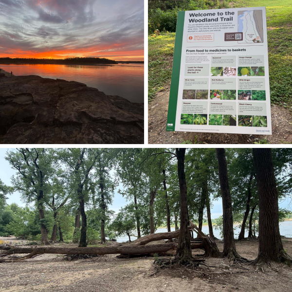
While Falls of the Ohio State Park is widely known for its fossil exploration, most visitors never walk the Woodlands Loop Trail. This trail gets top billing for its easy access to downtown Clarksville and Jeffersonville.
The 0.75 mile loop starts at the far northwestern corner of the parking lot. The difficulty is marked moderate and can even include maneuvering over tree debris from the Ohio River during high river seasons.
The fully shaded trail is a quiet oasis of flora and fauna. The park even outlines the food and medicinal plants you may find along the path, from river cane and pawpaws to wild ginger and Osage orange.
As you meander deeper into the trail, it begins a short descent down to the river level where the surface changes from dirt to sand and pebbles. This is where you can play among the scattered driftwood left by the river.
Wind your way to where the cliffed edges of the Ohio River are revealed to work your way back to the interpretive center.
Sunset Tip: Just as you reach the cliffed area with the fossil beds below, there is a special towering rock facing west that I call the “sunset rock”. If you are lucky enough to find this rock at sunset, it provides the most spectacular views of sunset in the entire Ohio River Valley.
Bonus Nature Trails in SoIN
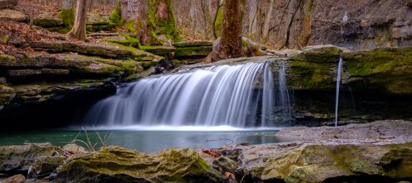
There are plenty of other beautiful places to take a stroll in nature around SoIN. I can think of two other nature preserves that you should also add to your list:
Loop Island Wetlands — New Albany
Nine Penny Branch Nature Preserve — Charlestown
Find one or all of these hidden gem nature trails. Remember: take only photos and videos and leave no trace behind you as you explore SoIN nature trails!
Looking for more adventure? Here are three additional secret trails that provide unforgettable experiences on both sides of the Ohio River.
Hidden Hiking Gems Just Across the River
For the next two hidden trails, venture across the Ohio River to Louisville, Kentucky, where my favorite local gems are situated in city parks.
Big Rock Cliff Trail at Cherokee Park in Louisville, Kentucky
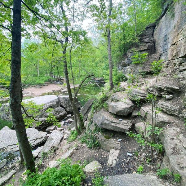
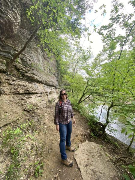
For this hike, you will make your way to Cherokee Park. You can drive or even ride your bike there on an accessible route. The Louisville city park is a gem of the region designed by Frederick Law Olmsted, widely considered the father of American landscape architecture.
Big Rock is tucked away in the far corner of the park at the intersection of Beargrass Road and Park Boundary Road. Pass by the playground and pavilion shelter and you’ll notice a small trail winding its way along Beargrass Creek. You’ll pass a small moss-covered waterfall before the challenging section begins. Take careful steps as you work your way along the rocky trail walled by stone at the cliff’s edge. As you ascend with light bouldering, you’ll come to “Big Rock”, a large formation jutting out over the creek. Use extreme caution as this trail is very rugged.
You can either do an out and back or continue on to where the trail emerges from the canopy at Beargrass Rd. Turn right to cross the creek and the intersection where the trail picks back up on the other side. Take the trail to the right to work your way back to Big Rock Park. There are several intersecting trails in this area so be sure you’re headed in the correct direction.
North Overlook Trail at Iroquois Park in Louisville, Kentucky
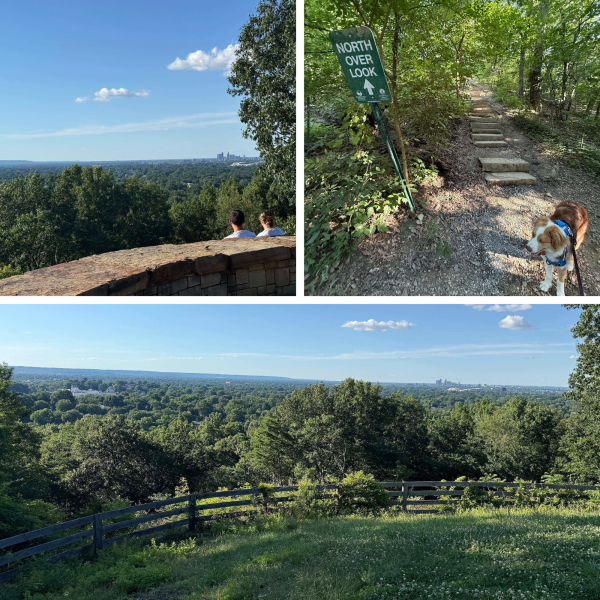
Even the drive to Iroquois Park takes you past some of Louisville’s iconic attractions from downtown and Old Louisville to Churchill Downs. Burnt Knob at Iroquois Park soars above the intersection of Southern Parkway at New Cut Road.
Enter at Iroquois Park Road and turn right to begin climbing up Rundill Road. On the left, there will be a small parking lot that is the starting point of a unique adventure. If you don’t find a parking spot there, you can continue on to a larger lot on the right side of the road and walk back.
At the corner of the overlook parking area is a challenging trail. If you are looking to get your heart pumping and the legs burning, follow the “North Overlook” sign straight up several stone steps. You will climb over 150 feet in just 0.3 miles.
Don’t fret. There is another option. You can walk up the paved Uppill Road (closed to motor vehicles most days) that is a gradual 1.5 mile ascend to the top.
Either route is worth the climb as you peer north at one of the best views of the Ohio River Valley and downtown Louisville. In 2016, the North Overlook was renovated with wheelchair-accessible paths, picnic areas, and enhanced scenic viewing spots.
While you’re atop Burnt Knob, frolic in the upper meadow at Summit Field. It’s a hidden gem brimming with wildlife and prairie plant species.
These are three unique and hidden spots that will make you fall in love with this region one hike at a time. Explore with curiosity. You never know what adventure awaits.
Southern Indiana
Sign-up to our monthly newsletter for insider blogs, special offers, and stay up... Read more — Email Sign-Up


Head to SoIN, get a hotel along the riverside or within one of our towns and... Read more — Places to Stay